An Engineering Process
Subsurface Utility Engineering (SUE) is a multi-phase process combining civil engineering, surveying, and geophysics. SUE involves managing certain risks associated with utility mapping at appropriate quality levels as defined in ASCE/UESI/CI 38-22 – Standard Guideline for Investigating and Documenting Existing Utilities. SUE is an important component of any civil engineering design to prevent change orders, utility damage, and project delays.
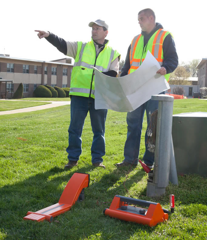
Informing the Design Professional
We investigate utility records to develop an extensive inventory of all existing utility systems. We then proceed to the site with electro-magnetic detection instruments to trace the course of each utility from a surface feature. Additionally, our crew conducts a sweep of the project site in an effort to discover undocumented or unknown utilities. If conditions are suitable, then Ground Penetrating Radar is used to investigate non-conductive utilities. Detected utilities are marked in the field.
Field markings and utility features are surveyed and processed to produce utility mapping. A|I|DATA utilizes professional judgment based on years of field and office experience to determine the most appropriate quality levels for utility mapping. We then provide you with a map that gives you the information needed to better manage the potential risks associated with existing underground utilities.
You don’t have to survey your project alone. A|I|DATA investigates and maps the critical utility systems in the project area. We work with you to determine the most appropriate depiction of each utility line based on field and record data.
Quality Level Designations According to ASCE 38-22
- Quality Level D (QLD) information comes solely from existing utility records.
- Quality Level C (QLC) information involves surveying visible aboveground utility facilities, such as manholes, valve boxes, posts, etc., and correlating this information with existing utility records.
- Quality Level B (QLB) information involves the use of surface geophysical techniques to determine the existence and approximate horizontal position of underground utilities.
- Quality Level A (QLA) information involves the use of nondestructive digging equipment at critical points to determine the precise horizontal and vertical position of underground utilities, as well as the type, size, condition, material and other characteristics.