Process

Beginning with the development of our proposal to you, we provide advice and recommendations for a utility investigation that will add value to your project. A|I|DATA will continue to consult with you throughout the process.

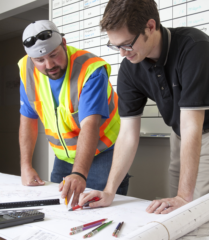
Based on our experience in utility investigation and locating, A|I|DATA applies standardized procedures and unique methods when needed to ensure the highest quality of information provided to our clients.

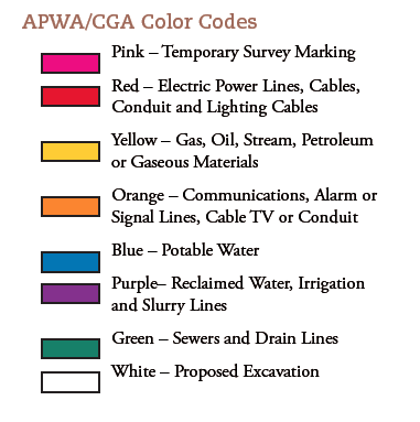
  1. Successful utility investigations begin with understanding what utilities exist within the project area. We research records from each utility owner to inform our search.
  2. A|I|DATA uses a variety of instruments and equipment and rigorous field investigation methods to discover and locate underground utilities.
  3. Documentation of the field findings, whether by sketch or CAD mapping, is the next step in our process.
  4. A|I|DATA’s professional staff will then ensure that the data delivered to you is well founded and based on the most reliable information.

Standards

A|I|DATA believes that its clients deserve and expect a professional approach to underground utility investigation. Our consistent, standardized way of doing business is one way to achieve that. While the profession of underground utility locating and subsurface utility engineering is evolving, there is a unifying approach that is already in place.

ASCE 38-22Standard Guideline for Investigating and Documenting Utilities is a consensus standard that describes the approach to and defines associated attribute data that is placed on plans. Published by the American Society of Civil Engineers, this document defines Subsurface Utility Engineering (SUE) and provides a descriptive framework for its practice. A|I|DATA has adopted ASCE 38-22 (and, before ASCE 38-22, its predecessor, ASCE 38-02) as its principal practice guideline.

American Land Title Association (ALTA)/National Society of Professional Surveyors (NSPS) – This published document sets the Minimum Standard Detail Requirement for ALTA/NSPS Land Title Surveys. This survey type is most commonly used for the survey of real property and comprises a map or plat for use by a title insurance company.

COMAR 09.13.06 – All surveys conducted in Maryland adhere to the Minimum Standards of Practice set by the Board for Professional Land Surveyors within the Department of Labor, Licensing, and Regulation.

A|I|DATA’s drawing files adhere to the national CAD standards and are compatible with MicroStation, Carlson, and Civil 3D.

APWA/CGA Color Codes